


This is the app for safe aircraft navigation. It has free and paid version and both has a wide functional. There are such functions as searching for airport in the current database, compass and navigation using user's coordinates, browsing the map and other aids for navigation.
Easy Flight Navigation
Functionality
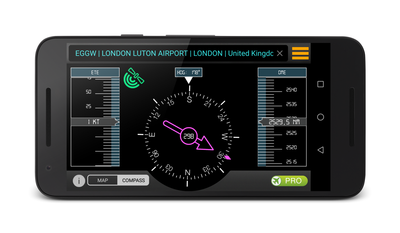
This screen is used to navigate to the selected airport. The arrow shows the direction in which you need to move as well as the angle of rotation relative to the target. In addition, it specifies the distance from the airport. The GPS module tracking is performed in the whole application.
This screen is used to navigate to the selected airport. The arrow shows the direction in which you need to move as well as the angle of rotation relative to the target. In addition, it specifies the distance from the airport. The GPS module tracking is performed in the whole application.
Technical solutions
The current location is determined in real time. States handler GPS module of the device has been added in order to obtain correct results. The BroadcastReceiver is used for it. Custom ruler components designed specifically for this application are used to display the target distance and speed.
The current location is determined in real time. States handler GPS module of the device has been added in order to obtain correct results. The BroadcastReceiver is used for it. Custom ruler components designed specifically for this application are used to display the target distance and speed.
Functionality
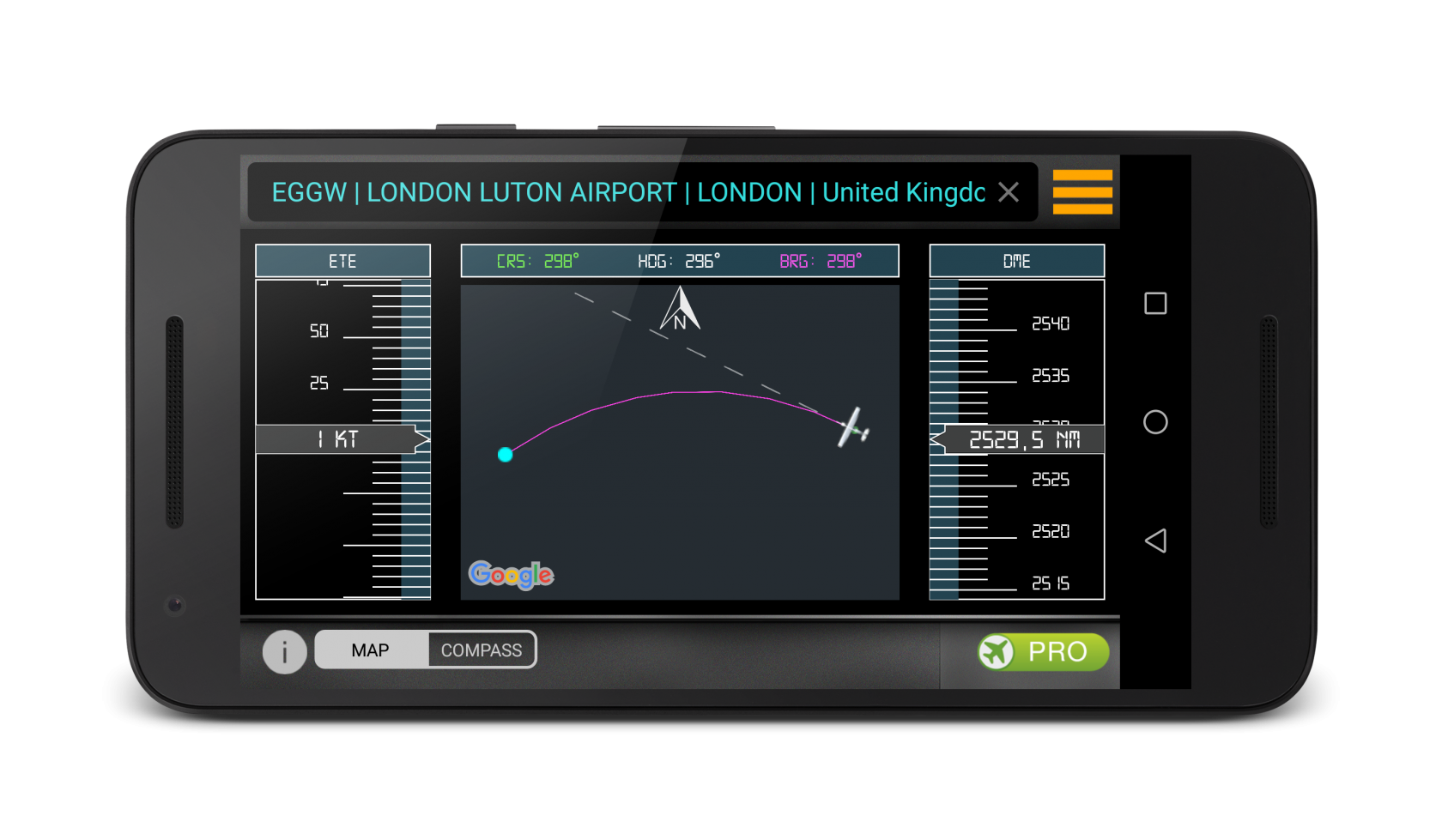
This screen is also used for navigation but unlike the first it gives an idea of the relative positions of objects on the map. Relative to the selected airport flight path is displayed as well as an icon that indicates your current position.
This screen is also used for navigation but unlike the first it gives an idea of the relative positions of objects on the map. Relative to the selected airport flight path is displayed as well as an icon that indicates your current position.
Technical solutions
Flight path is calculated and rendered with GoogleMaps. The direction is also determined with the GPS module of the device.
Flight path is calculated and rendered with GoogleMaps. The direction is also determined with the GPS module of the device.
Functionality
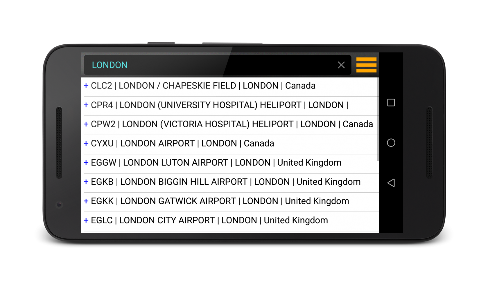
The application also allows to search for the airport. For search there is need to enter a keyword or words: country name, city, airport or its identifier. After that there can to select a goal from the dropdown list and start navigating.
The application also allows to search for the airport. For search there is need to enter a keyword or words: country name, city, airport or its identifier. After that there can to select a goal from the dropdown list and start navigating.
Technical solutions
The local SQLite database is used to get a list of the airports with SQL queries. The free version has a limit: you can choose only one airport in each country, the application disables the second choice and directs the user to the payment page. It is done with the database table that contains the selected airports earlier.
The local SQLite database is used to get a list of the airports with SQL queries. The free version has a limit: you can choose only one airport in each country, the application disables the second choice and directs the user to the payment page. It is done with the database table that contains the selected airports earlier.
Functionality
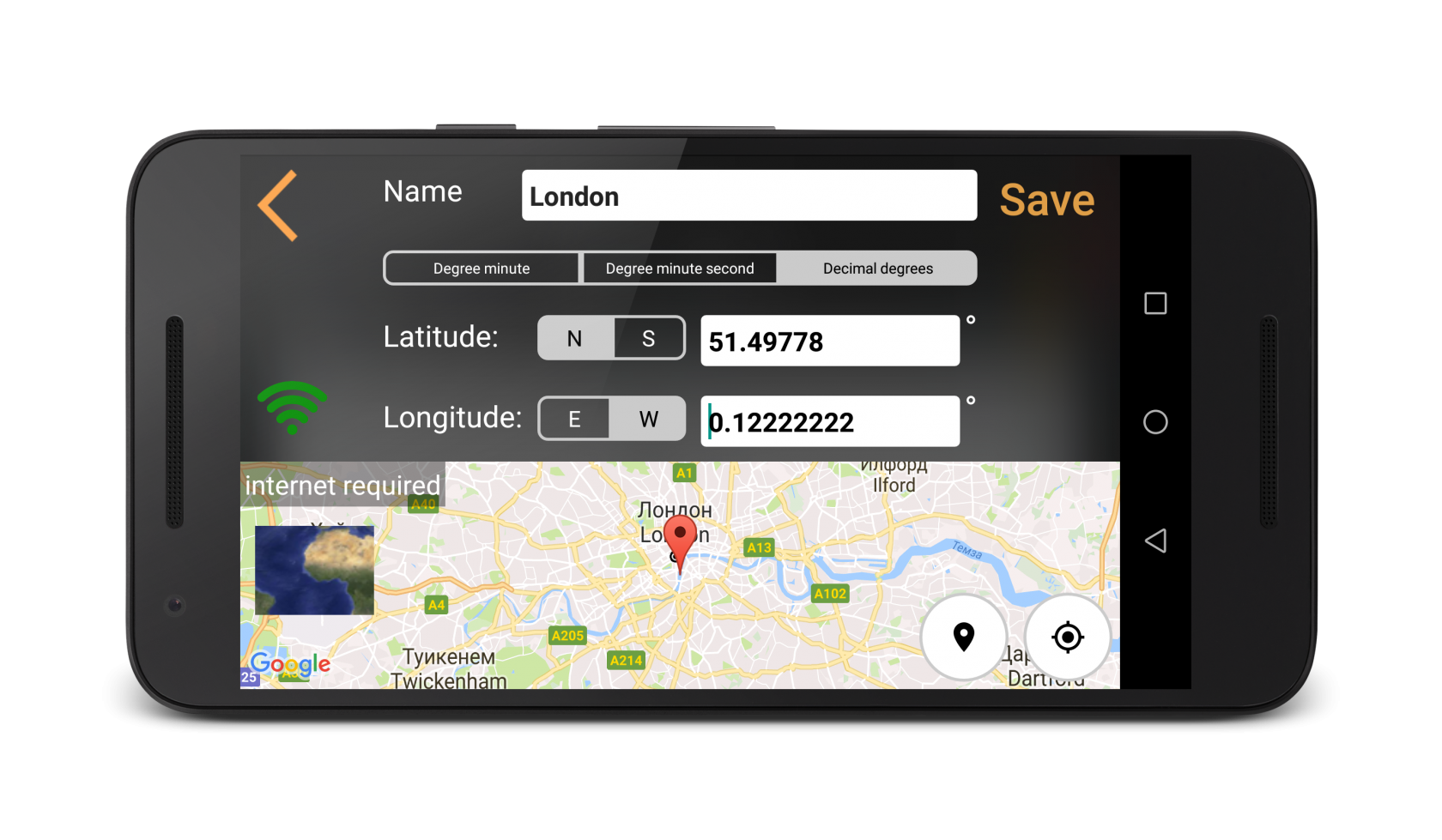
There is also the ability to add user's points for navigation. To do this user has to specify the coordinates and name of the object. The stored point is added to a list that is stored locally in the database.
There is also the ability to add user's points for navigation. To do this user has to specify the coordinates and name of the object. The stored point is added to a list that is stored locally in the database.
Technical solutions
The point selection is also available via with GoogleMaps. The selected point is stored in a local SQLite database with SQL queries.
The point selection is also available via with GoogleMaps. The selected point is stored in a local SQLite database with SQL queries.
Tools:
Java, GoogleMaps, GoogleApiClient, SQLite, Android in-app billing, PreferenceManager, BroadcastReceiver, LocationListener, RecyclerView, PercentRelativeLayouts, ButterKnife, Dagger 2, Javax.inject, Nucleus, Icepick, Blurry